 |
| Borrowed from HikingtheSmokys.com definitely want to make sure that I give full credit for |
Ever since we first started dating, there have been trails that we have wanted to do, Bridal Veil Falls, Savage Falls, Abrams Falls and others come to mind. Chimney Tops has been on the list for a while now, but for some reason we just never took the time to go. I made sure that it would be on our list for this vacation; as a matter of fact, I wanted it to be the first trail that we hit on this vacation. So we loaded up the car and worked it out with our hotel to have an early check in and went to Gatlinburg. We made good time and stopped at the Subway in Townsend for a lunch sandwich, hey when a craving for Subway hits I guess it has to answered, and made it to the room by 1.30. We had our stuff unpacked and backpacks in the car and were back on the road by 2. I began to worry after we passed the Sugarlands Visitor Center and all the signs about road work between there and Cherokee NC began to show up, but hey, it was Labor Day and surely they would not be doing road work on Labor Day. Right?
 |
| Sign at the Trail Head |
 After the 7 mile trip from the Sugarlands, I discovered that I was right, they would not be doing road work on Labor Day. The problem was, it was Labor Day and the parking lot was at capacity, even beyond capacity. There were people parked every where and every which way. I told my wife that I might not have thought this trip through as thoroughly as I had imagined. She just laughed and said we would find a spot. I had to drive over the loop before I could find a place to turn around and then waited for what felt like an hour before I could pull back out on the road to drive back to the parking area. I got lucky and was able to parallel park across from the parking lot and we did not have to walk from the spiral like some people did.
We walked over to the start of the trail and began going down. There were several groups of people coming out, and that gave me hope that the trail would not be crowded and that we were going to have the Tops with minimal people. I could see the new bridge that the Trails Forever people put in and it has to be one of the nicest hiking bridges I have seen. I was duly impressed. But it is a narrow bridge. I had my new Osprey Exos 48 Backpack on, filled with my day hike choices, along with a 2 Liter bladder, and my full Trangia kit and was a little wide for some of the more wider people standing on the bridge. I had to grab the bottom of my pack with one hand and shove it up over the railing, turning sideways and hang my pack over the rail to squeeze by them. I must not have said, "Excuse me," loud enough, but I did try and give them a pleasant smile. After crossing the first bridge, the trail goes to the right and across another bridge. I liked the view from this bridge more than the first due to Road Prong cascading down the mountains to join the West Prong of the Little Pigeon River. Then the trail turns back left and goes up a ridge before coming to bridge number 3 over Road prong and climbing again. Then after about 0.8 of a mile, the trail goes over bridge number 4, which is another scenic little setting. There were several groups of people here taking pictures and splashing in the water.
 |
| The sign at the split, Chimney Tops goes right |
 |
| The Stairs |
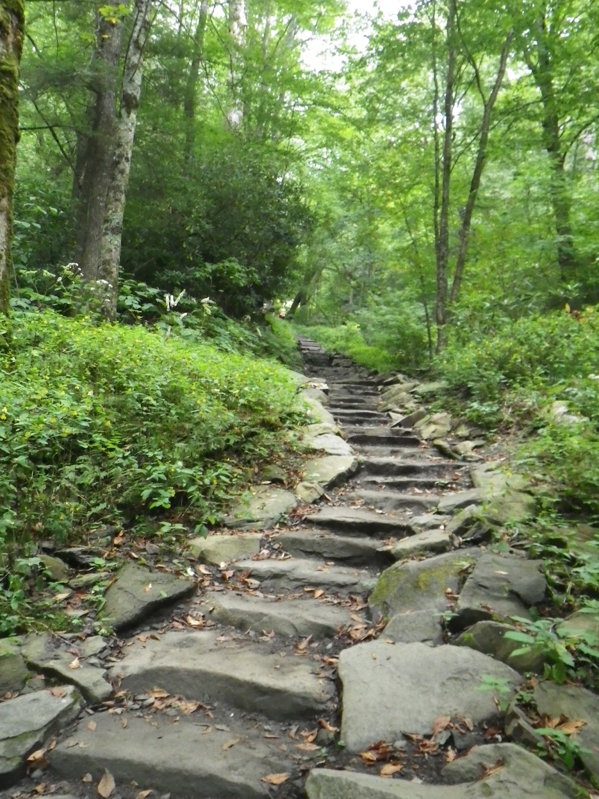
After 0.9 miles, the trail splits. Chimney Tops Trail goes off to the right, while Road Prong Trail goes strait to link up with the AT in 2.4 miles. I knew that we would be climbing up the mountain the entire trail. I knew that it was a practical 1,500 foot climb from the bridge to the top. I was expecting an uphill slog the entire way, and I knew that it was a steep climb. I can deal with the climbs, I do not mind following a trail all the way up to the top of a mountain, but after turning on to the Chimney Tops Trail proper, we ran into something that I was not expecting at all. Something that takes the wind right out of my sails and leaves me begging for mercy. Torture devices that are guaranteed to have me crying for Momma. We found, stairs! I am making it sound a lot worse than it really is. The stairs are nice and made out of stone found, I assume, on the mountain or close by. Without these stairs, the trail would not be hikeable at all. The rain would wash the trail away to nothing in one season I would assume without these stairs. My heart does go out to the men and women who had to carry all of those stones though and lay them into place. According to one older hiker that we ran into, there were 437(ish) stairs that one has to climb. I would say it was the stairs that made this trail more friendly. We met lots of people encouraging us that we were almost there, and saying how wonderful the view was today. We would take breaks to let families pass us and they would all say hi and how great the view was. Before reaching the stairs, not many fellow hikers would even say hi to us as we passed, and I like to try and be a friendly hiker and speak to everyone, even if it is just to say hi. My dad swore I would grow out of it when I was younger. We spoke to a couple who we had passed and then passed us in turn. I told them we were going to leap frog the rest of the way. The woman laughed. She asked everyone she saw how much longer it was to the top. When my wife and I left them, we went a little ways before running into the step counting man mentioned earlier. I made sure to have him tell her she was about there.
 |
| View right before the rain. |
The problem with the stair section is that there are not any real views to be had. The stairs climb up by a stream for most of their way. The Pale Jewelweed was in bloom when we went and it made the trek a little nicer having all of the yellow flowers lining our way. We even stopped and watched a bee go in and pollinate a couple flowers while we were chugging water on one of our stops.
 After about 0.9 miles, the trail tops out. There is a view looking out over the mountains. Then the trail evens out for the last .2 miles. I felt like I was walking the knife's edge of the mountain in this spot as we were literally on the top of the mountain going for the tops. I loved it. There were several larger groups of people at the tops when we arrived. Many were sitting at the bottom drinking water and eating snack. Many more were up on the tops lounging around and laughing. I pulled my camera out and took the picture to the right and turned to my wife and asked if she was read. At that moment, it started to pour the rain. I dropped my pack and grabbed my rain jacket and my pack cover and slid them on fairly quickly and my wife did the same with hers. People started scrambling down from the top, I watched an older couple ease their way down and slide to a stop on the roots in the picture. Many people just slid and jumped their way down the rocks. I stood there with my First Aid senses going bezerk. I just knew someone was going to take a bad tumble off those rocks and get hurt. Thankfully, no one was injured at all. Then except for another couple who had came up when we did, we were the only people on the tops. I couldn't help but laugh when my wife said that the blog was living up to its name in this situation. Then, just as suddenly as it came, the rain quit. I could not come here and not try to climb some part of the rocks. My wife said she was not interested at all in going all the way up. With my fear of heights, I knew I was not going to the top, but I had to climb some of the tops. Even in my high top hiking boots, I was sliding on some of the rocks and knew better than to push my luck. I climbed less than half way looked around and then came back down. The bottom picture is looking back down the towards the first picture. The rocks do not look it, but trust me it was slippery.
So, with us reaching the end of the trail and setting foot on one of the few clear mountain tops in the Smoky Mountains, my wife and I headed back towards the car. It was a tough hike, I will not lie to you. The uphill trudge goes on and on and on, but if you tough it out and make it to the top, the effort is worth it. Even with the rain and the cloudy views, I enjoyed this trail. The steps are uneven and not at all level, so if stairs give you trouble, you may want to keep that in mind. People say that if you do not go out onto the tops you are cheating yourself, but I know my limits and I know the conditions of the day that I went and I am super satisfied with my experience. I would recommend this trail to anyone looking for a little adventure, or to those who just like to get out and climb a mountain from time to time. If you feel like seeing a waterfall after hiking to the top, turn right when you come to the trail sign again. There are two waterfalls to see. One is about 0.3 miles up and the other is roughly 0.6 miles up the trail. We did not hike to the falls and we have not seen them, I am just letting you all know that they are there.


